
The River Nile from Space: A Lifeline Through the Desert
The majestic River Nile, a timeless symbol of life and civilization, takes on a breathtaking new perspective when viewed from the vast expanse of space. Satellite imagery provides us with an unparalleled "angle" to appreciate this incredible natural wonder, revealing not just a river, but a vibrant ribbon of green cutting through the arid Sahara.
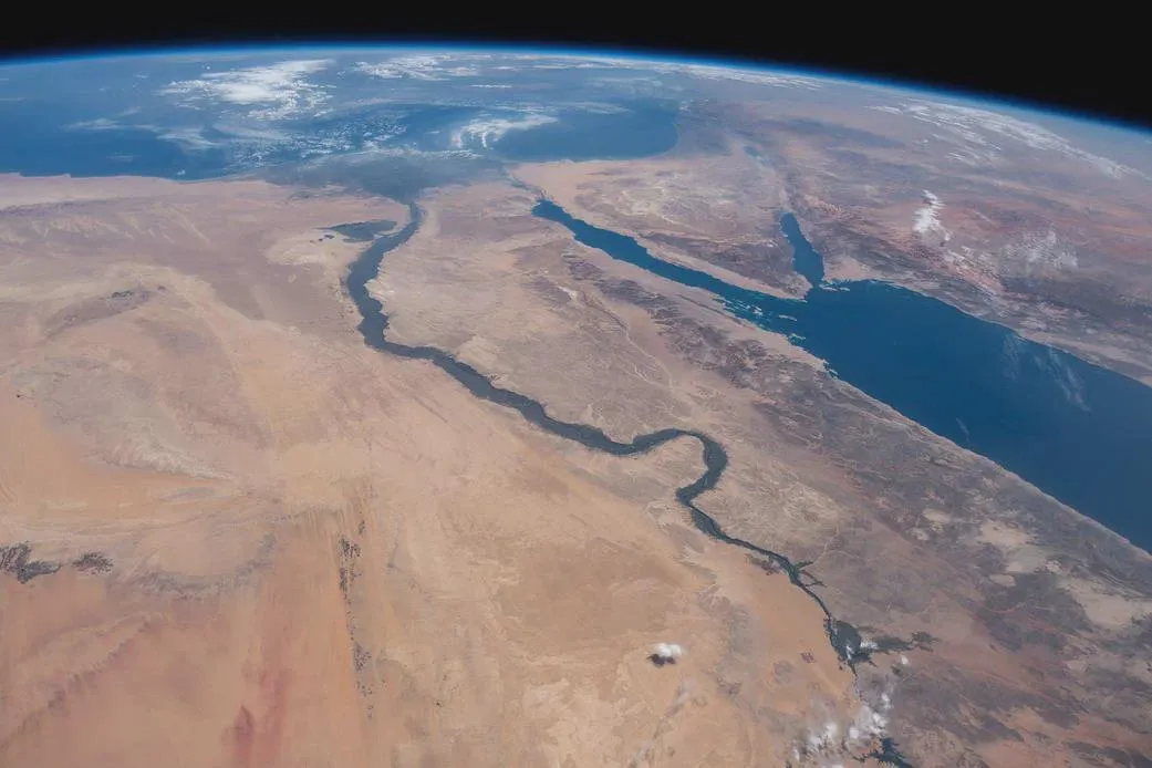
From orbit, what appears to be an immensely wide waterway is actually a fascinating optical illusion. While the Nile itself is approximately 500 meters wide, the surrounding landscape tells a different story. The lush, darker vegetation on either side, nurtured by the river's life-giving waters, extends for roughly 9 kilometers in each direction. This vibrant green band contrasts sharply with the pale desert, creating the visual impression of an extraordinarily broad river. It's a powerful testament to the impact of water in an otherwise desolate environment.
The Nile's Journey: From Disputed Sources to the Mediterranean
The journey of the Nile is as complex as it is long. Many wonder where such a massive volume of water originates, especially when seeing artificial reservoirs like Lake Nasser – created by the Aswan High Dam in the 1960s – which appear relatively small compared to the river's flow.
The Nile's true sources lie far to the south, with two primary tributaries: the White Nile and the Blue Nile. The Blue Nile draws its waters primarily from Lake Tana in Ethiopia, while the White Nile flows from even further south, originating from the Central African Great Lakes region. The ultimate source of the Nile, defined as the furthest point from its delta where flowing water can be found, remains a subject of scientific debate. Current contenders are anonymous geographic coordinates in Burundi (sources of the Ruvyironza and Rurubu rivers) and Rwanda (source of the Rukarara river). This enduring mystery only adds to the river's legendary status.
A Cradle of Civilization, Visible from Orbit
For millennia, the Nile has been the lifeblood of ancient civilizations, revered as a god and shaping the destinies of empires. Its annual floods brought fertile silt, allowing agriculture to flourish in a region that would otherwise be barren. Today, thanks to the vantage point of satellites, we continue to witness its profound influence on Earth's surface.
These views from space not only highlight the river's physical characteristics but also underscore its immense importance to human and natural ecosystems. The next time you gaze at an image of Earth from above, take a moment to appreciate the incredible stories etched into our planet's surface by wonders like the River Nile.


