
Witnessing Nature's Fury from Orbit: Mount Etna's Latest Roar
Mount Etna, Europe's most active stratovolcano, once again reminded us of its formidable power with a recent eruption. While the ground-level view offers a visceral experience, it's from the vantage point of space that we truly grasp the scale of such an event. Thanks to advanced Earth observation satellites like Sentinel-2, we can now witness the dramatic before-and-after transformation of the landscape.
The Eye in the Sky: Sentinel-2's Crucial Role
Part of the European Union's Copernicus programme, Sentinel-2 is a multi-spectral imaging mission designed to monitor Earth's land surfaces, vegetation, and coastal areas. Its high-resolution imagery is invaluable for a myriad of applications, from agricultural monitoring to disaster assessment. In the case of volcanic eruptions, Sentinel-2 provides critical data that helps scientists and authorities understand the extent of lava flows, ash plumes, and new geological formations.
A Landscape Transformed: Before and After
The images captured by Sentinel-2 offer a stark comparison, revealing just how much the area around Mount Etna has changed in the wake of its latest activity. The 'before' image shows the familiar terrain, while the 'after' shot vividly highlights the fresh imprints of the eruption.
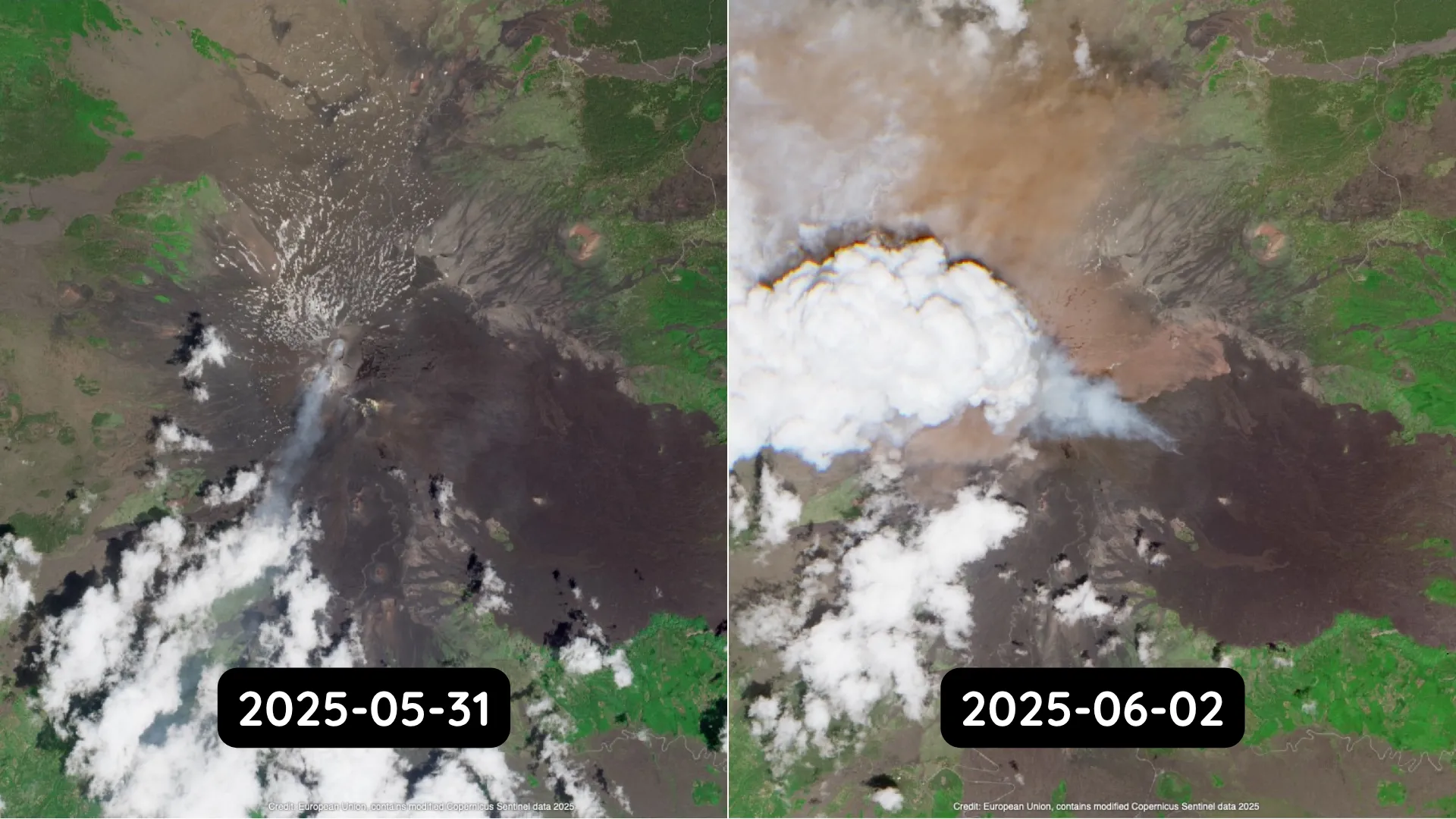
Unpacking the 'New Light Brown Area': Ash Deposits
One of the most striking features visible in the 'after' imagery is the extensive 'new light brown area'. This distinct coloration is indeed indicative of fresh ash deposits that have settled across the surrounding landscape. Volcanic ash, comprised of pulverized rock and glass, can have significant impacts on agriculture, air quality, and infrastructure. Satellite data like this is essential for mapping the spread of ash, which helps assess damage and guide recovery efforts.
The Value of Satellite Monitoring
The ability to monitor dynamic geological events like volcanic eruptions from space is a testament to the incredible advancements in space technology and Earth observation. Satellites like Sentinel-2 provide indispensable data for scientific research, disaster preparedness, and environmental management, allowing us to better understand and respond to the powerful forces shaping our planet.
These before-and-after perspectives not only offer a visually compelling narrative of nature's power but also serve as a vital tool for those on the ground, helping to navigate the aftermath of such dramatic events.


