
Unveiling Mars: A Historic Look Back with Viking 1's Iconic View
Step back in time to 1976, a pivotal year in our quest to understand the Red Planet. It was then that NASA's groundbreaking Viking 1 mission delivered an image that would forever shape our perception of Mars, revealing intricate details of its ancient landscapes. This remarkable photograph showcases the vast Argyre Basin, the striking Galle Crater, and the rugged Charitum Montes.
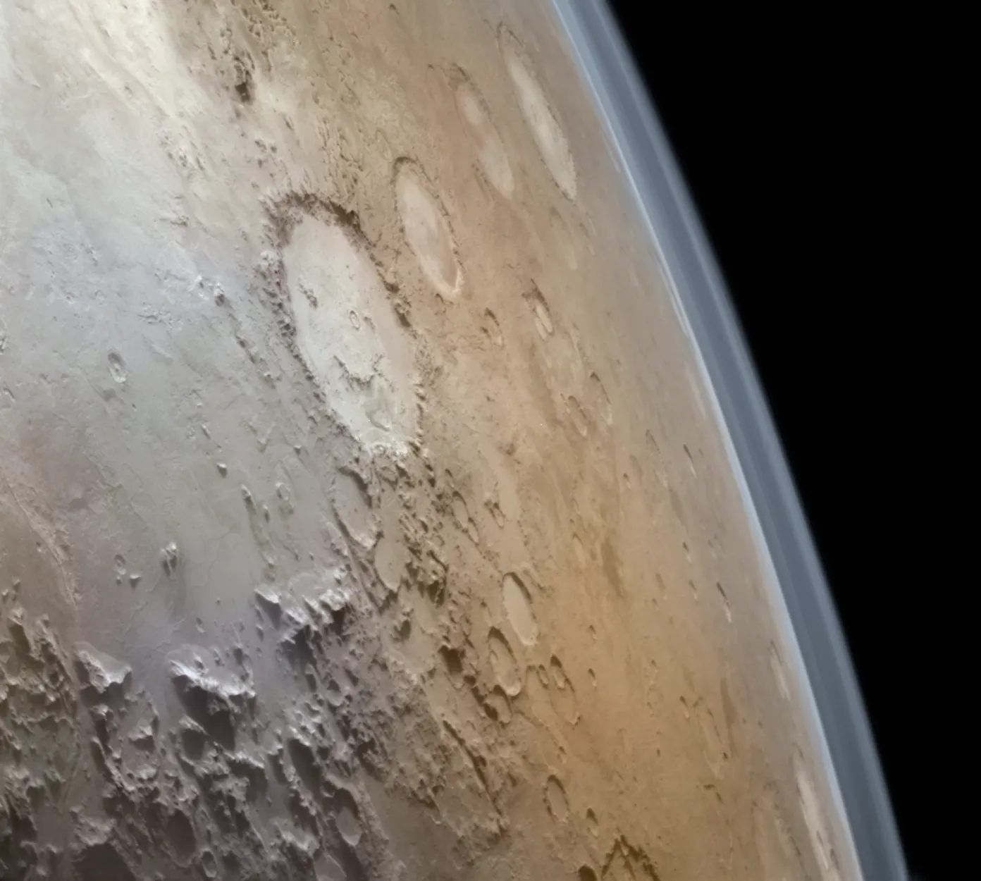
The Martian Landscape Revealed
This composite image offers a breathtaking perspective of some of Mars' most significant geographical features. The Argyre Basin, one of the largest impact basins on Mars, spans an impressive 1,800 kilometers (1,100 miles) in diameter. Its sheer scale hints at a cataclysmic impact event billions of years ago.
Nestled within this grand panorama is Galle Crater, famously known as the "Happy Face Crater" due to its distinct shape resembling a smiling face. While the original image here might not show its full "face" due to perspective or cropping, its presence is a testament to the diverse and sometimes whimsical geomorphology of Mars.
Further contributing to the dramatic scenery are the Charitum Montes, a range of mountains bordering the Argyre Basin. These ancient highlands provide a stark contrast to the smoother basin floor, offering clues about Mars' geological history and the processes that shaped its surface over eons.
Viking 1: A Legacy of Exploration
Launched in 1975, Viking 1 was part of NASA's ambitious Viking program, the first American mission to successfully land a spacecraft on Mars and return images and data from the surface. Before its lander touched down, the Viking 1 orbiter meticulously mapped the planet, providing unprecedented views like this one. These images were crucial for site selection and for a broader understanding of Martian geology, atmosphere, and potential for life. The Viking program fundamentally transformed our understanding of Mars, paving the way for future missions.
From Raw Data to Iconic Image
It's important to appreciate the journey this image undertook from raw data to the vivid representation we see today. The initial data captured by Viking 1 was in black and white, often requiring significant processing to enhance details and bring out the true colors (or approximate colors) of the Martian surface. This particular image is a testament to the careful work involved in transforming raw scientific data into accessible and visually stunning insights. Credit for the raw data goes to NASA/JPL, with the processing expertly carried out by Andrea Luck.
A Timeless Glimpse
Decades later, this image from Viking 1 remains a powerful reminder of humanity's enduring curiosity about the cosmos. It's a snapshot from a pioneering era of space exploration, continuing to inspire new generations of scientists and enthusiasts to look up and wonder what other secrets the Red Planet might hold.


